BREWER (BREWERER) CEMETERY
This is a small burial site located in Section 4 of Marion Township .5 miles south of County Road 66 (Kenton-Galion Rd.) and 270 feet west of State Route 423 containing .02 acres. The site is difficult to find. It is on a knoll across a small creek just west of a house. There is one stone and possible two field stones. This cemetery is possibly misnamed because the land was never owned by the Brewer family.
GRAND PRAIRIE CEMETERY
This large cemetery is located at Brush Ridge, Ohio in Section 17 of Grand Prairie Township at the junction of State Route 423 and 231 and County Road 67, containing 22 1/4 acres. The Grand Prairie Cemetery Association was formed March 8, 1881.The cemetery originally consisted of 6.25 acres which were purchased from Hannah and S.S. Bibler for $65.00 per acre. The entranceway was constructed in 1928. The records of the cemetery association are complete and include the transfer of bodies from other areas. Tabulation was taken for this cemetery until 1908 unless later dates were on : the same marker with dates earlier than 1908.
GERMAN REFORMED CEMETERY
The cemetery is located in Section 30 of Big Island Township, 30 feet east of Township Road 31(Agosta Meeker Rd), 30 ft. South of State Route 95 (Marion Agosta Rd), containing .5 acres. There is a wire fence on three sides and the grounds are well tended. Several stones are broken and some are gone. There was a German Reformed Church on this site in 1865. No burial records are available.
PAWPAW CEMETERY
The cemetery is located in Section 32 of Grand Township on the northwest corner of State Route 37 (LaRue-Marseilles Rd.)and County Road 20 (Miles Rd.), containing .59 acres. This cemetery is in good condition, well mowed and trimmed. There is a good wire and wood fence on four sides with a gate. Only a few stones are down or broken. Ira Anderson deeded the land to the Paw Paw M.E. Church on March 31, 1892 for the sum of $1.00.
YOAKAM CEMETERY
The cemetery is located in Section 22 of Grand Township .3 miles south of Township Road 26 (Marseilles-Galion Rd.) and 20 feet east of Township Road 28 (DeCliff Rd.), containing .02 acres. It is a small family cemetery surrounded by a white board fence with a gate. It is fairly well kept but only two stones are standing.
BURTSFIELD CEMETERY
The cemetery which is also called Rocky Fork Cemetery is located in Section 27 of Grand Prairie Township, .6 miles west of State Route 4 and .3 miles south of County Road 26 (Marseilles-Galion Rd.), containing .6 acres. This cemetery is tended about twice a year. Several graves are marked with field stones. Several stones are broken. Foot stones are all in place. John Van Meter sold this land and a roadway to the trustees April 11, 1846.
MARION MAUSOLEUM
This mausoleum is located in Section 26 of Marion Township, south of State Route 95 and .3 miles east of State Route 529. On February 22, 1917 the Marion Mausoleum Association held its first organizational meeting, electing the following officers: W.H.Holverstott, president; Frank H. King, vice president; W.E.Harkness, secretary; S.H. De Long, treasurer; and trustees Louis H. Flocken, Dr. A.B. Lawson, J. B. Gunder and W.H. Bones. The objectives of the organization was to purchase land on which to construct a compartment mausoleum and provide for the perpetual care and Maintenance of the mausoleum. The builders were I.N. Latchaw and A.F. Sievert. A non profit organization was formed May 17, 1918 and the mausoleum was dedicated on June 30, 1918. The Association is active at the present time and all records are available. The mausoleum is open to the public on Memorial Day and the Fourth of July each year.
NO.55 MARION, OLD CEMETERY
This cemetery has been known by three different names: the Old Marion Cemetery, Pioneer Cemetery and the Quarry Street Cemetery. These inscriptions were compiled by the Marion, Ohio, William Hendricks Chapter of the DAR in the 1930's. This cemetery is located in Section 22 of Marion Township 500 feet east of State Route 423 and 1,200 feet north of State Route 309 on Quarry Street in Marion, containing 2.5 acres. It was laid out in the original plat in 1822 by Eber Baker, founder of Marion. The old cemetery stands alone. The iron fence which once surrounded the cemetery has been torn down long ago. Most of the tombstones have been destroyed by vandals or removed. In 1976 there was pile of broken tombstones on the site. Around 1930 the William Hendricks Chapter of the DAR took charge of the task of restoring this cemetery which had been abandoned after the present day Marion Cemetery had been established in 1857. The restoration was completed in 1938. Since that time vandals have completely destroyed the cemetery site. It contains the remains of Pvt. David Potts who was present at the surrender of General Charles Cornwallis at Yorktown in 1781. He died May 25, 1837. There is a new stone for this Revolutionary War soldier placed in 1977. On July 20, 1854 a cholera epidemic struck Marion and claimed sixty five lives. These victims are buried at this site. Some bodies were moved from here to the new Marion Cemetery after 1858.
NO.108 NEFF CEMETERY
Compiled by Jim, Barbara and Ellen Midlam on August 21, 1977.
The cemetery is located in Section 20 of Tully Township, south of County 9 Road 67 (Morral-Kirkpatrich Rd.) and .25 miles west of County road 171 (Martel Rd.), containing .7 acres. The cemetery is in the church yard of the German Sixteen Methodist Church It is fenced on three sides and is well kept and in good condition. On August 21, 1929 the German Methodist Church deeded ½ acre to the township trustees. There was an English Sixteen Methodist located directly north just above the Crawford County line. There are many Marion County residents in this cemetery.
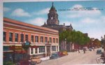
Main Street Marion Ohio
Search This Blog
Blog Archive
-
▼
2008
(7)
-
▼
March
(6)
- Rudd Company SkimStone Bonding PrimerSkimStone Bon...
- A Trip from Germany in the 1700's
- Marie told about the old Lapham Brick, Rev. Crabtr...
- BREWER (BREWERER) CEMETERYThis is a small burial s...
- HISTORY OF MARION COUNTYWar of 1812. The first acc...
- Morral, OhioFrom Wikipedia, the free encyclopediaW...
-
▼
March
(6)
No comments:
Post a Comment